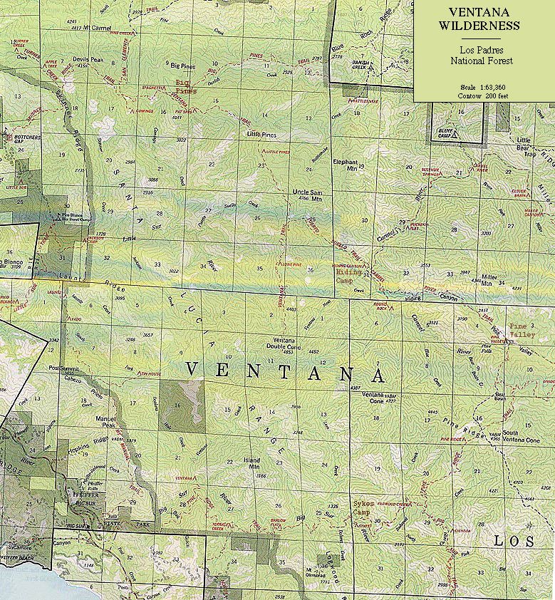
From Bottcher's Gap, located 23 miles south of Carmel (directions), we penetrated deep into the heart of the Ventana Wilderness on our way to Pfeiffer State Park. Our trip would take us nearly 50 miles, heading mostly south through miles of the rugged backcountry terrain rarely visited. The first night we hiked in only a mile from the trailhead, up a small creek drainage to a nicely rounded hilltop where we set up camp beneath a shapely oak tree. The night lent us spectacular views of the grand canopy of stars and in the morning gave way to panoramic views of the wilderness. Before you travel any farther along this trail, I suggest filling up your water bottles here or earlier because water is difficult to obtain on the dry ridge tops. The natural springs we were told about never appeared. Ask the Forest Service employee at Bottcher's Gap for suggestions on water locations. If you are interested in looking at a trail map [268K JPEG], here you go; this will take awhile to download.
 The following morning (day 1) we traversed chaparral ridgelines and dipped into
nicely shaded oak woodlands along the north-facing slopes. The day was hot but
pleasant, and then it happened. The black flies and other pestering bugs attacked
us in full force--relentless in their pursuit of flesh! The bugs were worse
than I have ever experienced in California, and I swore I would bring a bug
net next time. The onslaught of bugs, I assume, were so "thick" because California
had received record rainfall this year. Despite the bugs, the scenery was spectacular
and serene as we walked passed through dappled fields of wildflowers everywhere.
Purple lupine, orange poppies, Indian Paintbrush and lots of other brilliant
flowers colored pink, white, lavender and yellow covered the rolling hills.
This section was short, only about a half days hike, and ended us in a place
called "Big Pines." This camp was actually a side trail leading out of the wilderness
and off the ridge line, but a nice resting spot with fresh water, cystal clear
and ice-cold. Lots of big ponderosa trees provided shade.
The following morning (day 1) we traversed chaparral ridgelines and dipped into
nicely shaded oak woodlands along the north-facing slopes. The day was hot but
pleasant, and then it happened. The black flies and other pestering bugs attacked
us in full force--relentless in their pursuit of flesh! The bugs were worse
than I have ever experienced in California, and I swore I would bring a bug
net next time. The onslaught of bugs, I assume, were so "thick" because California
had received record rainfall this year. Despite the bugs, the scenery was spectacular
and serene as we walked passed through dappled fields of wildflowers everywhere.
Purple lupine, orange poppies, Indian Paintbrush and lots of other brilliant
flowers colored pink, white, lavender and yellow covered the rolling hills.
This section was short, only about a half days hike, and ended us in a place
called "Big Pines." This camp was actually a side trail leading out of the wilderness
and off the ridge line, but a nice resting spot with fresh water, cystal clear
and ice-cold. Lots of big ponderosa trees provided shade.
 The
following day (day 2) we mistakenly continued down the Big Pine Trail until
we realized that we needed to go back up to the ridgeline. From the ridgeline
we continued south mostly along contour lines toward the Ventana Double Cone
where ferns and Yucca plants happily intermingle above the valley below. Along
the way I also met a curious bobcat that just stared at me for about 10 seconds
then trotted off. Three (3) hours later we came to a major junction: one trail
continued south toward Ventana Double Cone and another one (called the Puerto
Suello Trail) descended eastward into the Carmel River headwaters. We chose
the latter trailhead down to the Carmel River.
The
following day (day 2) we mistakenly continued down the Big Pine Trail until
we realized that we needed to go back up to the ridgeline. From the ridgeline
we continued south mostly along contour lines toward the Ventana Double Cone
where ferns and Yucca plants happily intermingle above the valley below. Along
the way I also met a curious bobcat that just stared at me for about 10 seconds
then trotted off. Three (3) hours later we came to a major junction: one trail
continued south toward Ventana Double Cone and another one (called the Puerto
Suello Trail) descended eastward into the Carmel River headwaters. We chose
the latter trailhead down to the Carmel River.
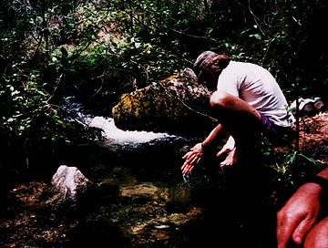
I'm sure this overgrown trail is where I got poison oak from hacking through a jungle of brush to reach the bottom. Quite obviously we were one of the first seasonal hikers to reach this area as we hacked through poison oak and jumped over many fallen trees. This canyon had been ravaged from earlier winter storms too. In spite of this adversity, this arduous journey began to bring about a sense of discovery as we descended into the remote Carmel River Valley. When we finally reached the Carmel River, a fine sight to see, we immediately plunged in the river to rinse off bug snot and poison oak oils. This was one of the groups favorite camping spots known as "Hiding Camp" for its remoteness.
 The
following sunrise (day 3) we traveled up the Carmel River for a few miles and
then swam in its cool water coursing through polished granite walls and lined
by smooth-barked Madrone trees. You can reach this section of the river along
a spur known as Round Rock (map). After a refreshing
swim, we traveled up the eastern flank of this valley and soon realized ticks
were crawling all over us. One of us had 8 of them on him with one actually
beginning to burrow its little head into his skin. So watch out! Near the Carmel
River check yourself regularly for ticks. Things got better as we rose above
the Carmel River Valley until we reached Pine Valley--truly heaven. The breeze,
the meadow, and the pine trees must have scared the bugs away. This place was
amazing!
The
following sunrise (day 3) we traveled up the Carmel River for a few miles and
then swam in its cool water coursing through polished granite walls and lined
by smooth-barked Madrone trees. You can reach this section of the river along
a spur known as Round Rock (map). After a refreshing
swim, we traveled up the eastern flank of this valley and soon realized ticks
were crawling all over us. One of us had 8 of them on him with one actually
beginning to burrow its little head into his skin. So watch out! Near the Carmel
River check yourself regularly for ticks. Things got better as we rose above
the Carmel River Valley until we reached Pine Valley--truly heaven. The breeze,
the meadow, and the pine trees must have scared the bugs away. This place was
amazing!
 We dropped our packs under a shade tree just like the hearty
pioneers must have done a century ago declaring, "this is it!" Pine Valley is
actually privately owned and you will run across a beautiful cabin and set of
corrals at the far end of the valley. In addition to the lush meadows, the perimeter
was punctuated by a grand fold of eroded sandstone rocks, most likely part of
an ancient seafloor at one time. As we climbed onto this sticky rock, it reminded
me of the strange rocks found near Laguna Beach, CA (if you have ever been there).
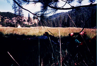
Our camp was lovely as we slept in the meadow next to a groovy creek (shown
here).
We dropped our packs under a shade tree just like the hearty
pioneers must have done a century ago declaring, "this is it!" Pine Valley is
actually privately owned and you will run across a beautiful cabin and set of
corrals at the far end of the valley. In addition to the lush meadows, the perimeter
was punctuated by a grand fold of eroded sandstone rocks, most likely part of
an ancient seafloor at one time. As we climbed onto this sticky rock, it reminded
me of the strange rocks found near Laguna Beach, CA (if you have ever been there).
Our camp was lovely as we slept in the meadow next to a groovy creek (shown
here).
 The
next day (day 4) we were on our way to see redwoods, Sykes Camp to be specific,
where we had heard hot springs existed. With fortitude we climbed from Pine
Valley several miles south toward Pine Ridge Trail, one of the best old trails
I have seen. This trail must have been a mule train at one time judging by its
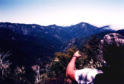
broad and butressed trail and lined by aging communication lines. Gracefully
we peaked out to see below us the distant Carmel Valley (shown as the first
photo in this series) and Pine Valley farther to the east. As we reached the
ridgeline, signs of a great fire began to steal our shade as we worked our way
into the Big Sur River watershed. In the distance we could see the foggy coast
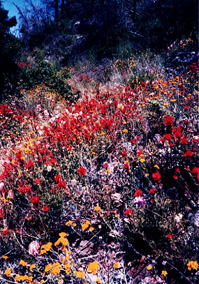
and lots of chaparral and sagebrush below. As we began our long descent to Sykes
Camp, a rattler snake spooked me on our way down this hot, steep and sometimes
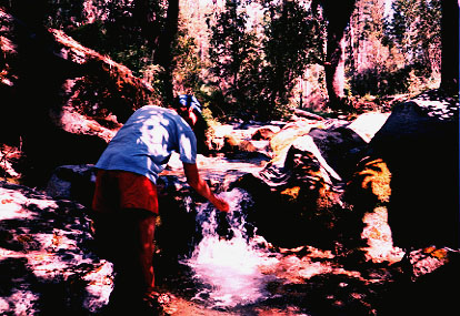
windy pathway. Surprisingly we also encountered many wildflowers here as well
(shown here). After about 15 miles of hiking, we arrived in the lush redwood
grove of Sykes Camp, which was like an oasis among the desert. We set up camp
beneath the redwood grove and then asked where we could soak our feet in the
hot springs. What a treat this was, especially after hiking nearly 40 miles.
We had only 10 miles to go to reach Pfeiffer State Park, our final destination,
and this was mostly downhill.
The
next day (day 4) we were on our way to see redwoods, Sykes Camp to be specific,
where we had heard hot springs existed. With fortitude we climbed from Pine
Valley several miles south toward Pine Ridge Trail, one of the best old trails
I have seen. This trail must have been a mule train at one time judging by its
broad and butressed trail and lined by aging communication lines. Gracefully
we peaked out to see below us the distant Carmel Valley (shown as the first
photo in this series) and Pine Valley farther to the east. As we reached the
ridgeline, signs of a great fire began to steal our shade as we worked our way
into the Big Sur River watershed. In the distance we could see the foggy coast
and lots of chaparral and sagebrush below. As we began our long descent to Sykes
Camp, a rattler snake spooked me on our way down this hot, steep and sometimes
windy pathway. Surprisingly we also encountered many wildflowers here as well
(shown here). After about 15 miles of hiking, we arrived in the lush redwood
grove of Sykes Camp, which was like an oasis among the desert. We set up camp
beneath the redwood grove and then asked where we could soak our feet in the
hot springs. What a treat this was, especially after hiking nearly 40 miles.
We had only 10 miles to go to reach Pfeiffer State Park, our final destination,
and this was mostly downhill.
 (Day
5) Slowly we woke up beneath towering redwoods and, unfortunately, to the fact
that much of our breakfast had been eaten by chipmunks. No problem, we thought,
because this was our last day. After taking a quick dip in the river, we headed
out and casually meandered down the Pine Ridge Trail toward Pfeiffer State Park
Campgrounds. Soon we ran across many incoming hikers struggling up the trail
on this typically crowded weekend. As they writhed in pain from the long uphill
haul, I smugly smiled at them because I knew we had seen over 50 miles of Big
Sur few people have experienced and we were heading home. Even with the horrendous
bugs I would do this trip again, I thought. The plant diversity, sense of solitude,
wildflowers, crystal clear rivers, and towering redwoods made it all worth it.
(Day
5) Slowly we woke up beneath towering redwoods and, unfortunately, to the fact
that much of our breakfast had been eaten by chipmunks. No problem, we thought,
because this was our last day. After taking a quick dip in the river, we headed
out and casually meandered down the Pine Ridge Trail toward Pfeiffer State Park
Campgrounds. Soon we ran across many incoming hikers struggling up the trail
on this typically crowded weekend. As they writhed in pain from the long uphill
haul, I smugly smiled at them because I knew we had seen over 50 miles of Big
Sur few people have experienced and we were heading home. Even with the horrendous
bugs I would do this trip again, I thought. The plant diversity, sense of solitude,
wildflowers, crystal clear rivers, and towering redwoods made it all worth it.
[ Home | Index | Photo Gallery ]