

Global Positioning Systems (GPS)
for GIS
Units :
1
Transfer : CSU/UC
Hours Per Week :1
|
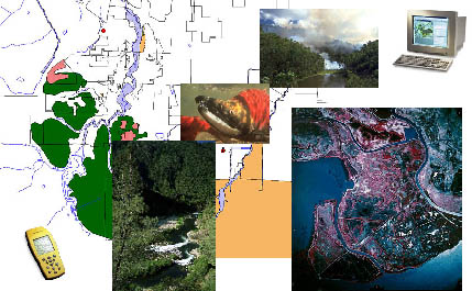
Theory and hands-on training to integrate the GPS into the GIS for mapping purposes. Use of professional GIS units with focus on GPS technology and map making based upon field collected data. Student project to collect and integrate the GPS with the GIS. (GEOG 86) Course Student Learning Outcomes - Geography - GEOG 0086 CSLO 1 - List 5 core steps on how a GPS works. CSLO 2 - Determine and identify critical setup items needed before field collection of GPS. CSLO 3 - Develop data dictionary on scratch paper then computer software keeping in mind an iterative process. CSLO 4 - Mark and navigate to GPS waypoints. CSLO 5 - Differential correct collected field data. |