

Units : 3 Transfer : CSU/UC
Hours Per Week :3
|
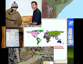
Builds upon Intermediate GIS with a focus on advanced technical skills and mapping, such as completing a research project and building a map portfolio. Working with spatial datrabases, GIS modes, extensions, vector and raster analysis, cartographic presentation and large-format output are examined. (GEOG 93) Course Student Learning Outcomes - Geography - GEOG 0093 CSLO 2 - Draft a flowchart of necessary layers and other data needed for project. CSLO 3 - Organize data for future queries and analysis determined by CSLO 4 - Assess appropriate "geovisualization" tools to illustrate highly detailed terrain related problems or requirements, such as the use of LIDAR data (which is high resolution topographic rendering of landscapes) CSLO 5 - Assemble a portfolio of well-organized, purposeful maps that solve real-world, spatial problems using industry standard methods and geographic layers.
|