Symbolizing with Categories
Symbolizing Features
assigning colors, markers, sizes, width, patterns, etc.
frequently organized by themes and standardized
transportation, hydrology, civic, etc.
blue lake, swamp, school, etc.
logical meaning, mimic nature
icon of object - e.g. fire hydrant
vary size of symbol
thickness of lines for streams
size of points for cities
feature type (feature class) influenced by scale
point or polygon
Making your Map
mapping a single symbol
locations, pattern of
roads
, parcel base map
using subsets (
commercial zoning
, all crimes, burglaries,
commercial burglaries
)
mapping by categorical attributes
ability to expand -
roads
(freeway, highway, primary arterial, secondary arterial)
ability to simplify -
zoning categories
ability to query - streams with gravel (spawning), thick canopy, dams, invasive species
..
analyzing geographic patterns
distribution of features and events
differentiates features - e.g.
Northern Cal Cities
- (800K pdf)
Index
 Symbolizing with Categories
Symbolizing with Categories
Symbolizing with Categories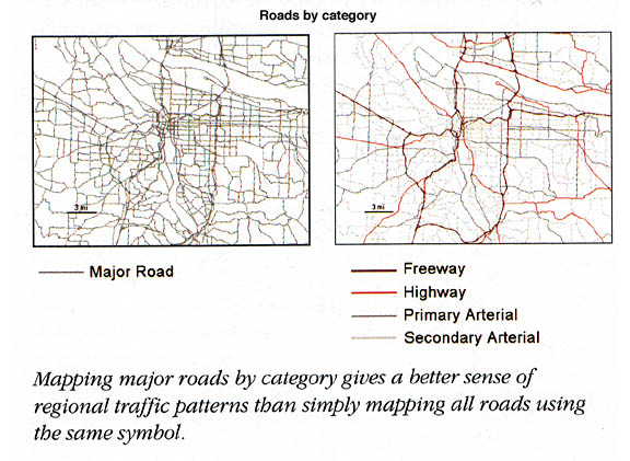