Setting up the GIS
What information do you need? What problems
are you solving? What to Map?
- Must understand the "business process"!
- What are your goals?
- What type of input (available data)?
- What type of outputs (queries and analysis)?
- Examples:
- Criminal Justice - simple location
of crimes, crimes by type, associated landuse, amount of monetary
damage, number of people involved, etc.
- location and other factors?
- Urban Planning - parcel boundaries,
general landuse, zoning, assessor parcel number, address, associated planning
permits & cases, dwelling size, etc.
- how will use map
depending on audience?
- Creek Survey - channel width, water
level & flow, substrate, bank condition, landuse, vegetation width,
canopy cover, understory shrubs, wetland species
- how much data to gather in the
field?
- how to organize collection of
data?
- Often become apparent in the process
(iterative process)
Preparing your Data
- assigning location of features
- geographic coordinates or address
- tapping into existing databases
- must have primary key to join or
link
- creating databases
and assigning category values
- must have code that identifies type
or attributes
- must have level of detail for simple
and complex maps
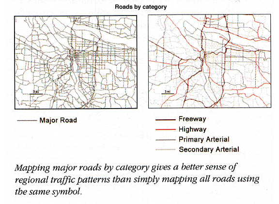
- simple
roads vs. detailed roads
- how many categories? (6 or 7 at
most)
- must
have data dictionary to indicate details
- layers, attributes
(heirarchy & subtypes), value codes
Index